UPDATE: A massive winter storm is wreaking havoc across the Midwest and Great Lakes region, severely disrupting travel just after Thanksgiving. The storm hit on November 25, 2023, affecting millions of Americans as they return home from holiday celebrations.
Travelers faced significant delays at major airports, with Chicago and St. Louis reporting wait times of approximately one hour early Saturday morning. Meteorologists warn that another storm could follow, bringing freezing rain and heavy snow to the Northeast early next week, threatening to extend travel disruptions further.
The National Weather Service (NWS) has issued winter storm warnings and advisories from Montana to Ohio. Some areas received more than 8 inches of snow by Saturday morning, with Northern Iowa already seeing substantial accumulations.
On westbound Interstate 70 near Terre Haute, Indiana, at least 45 vehicles crashed, forcing highway closures, though thankfully, no serious injuries were reported. Snowfall rates could exceed one inch per hour in certain locations, creating treacherous conditions for both air and ground travel.
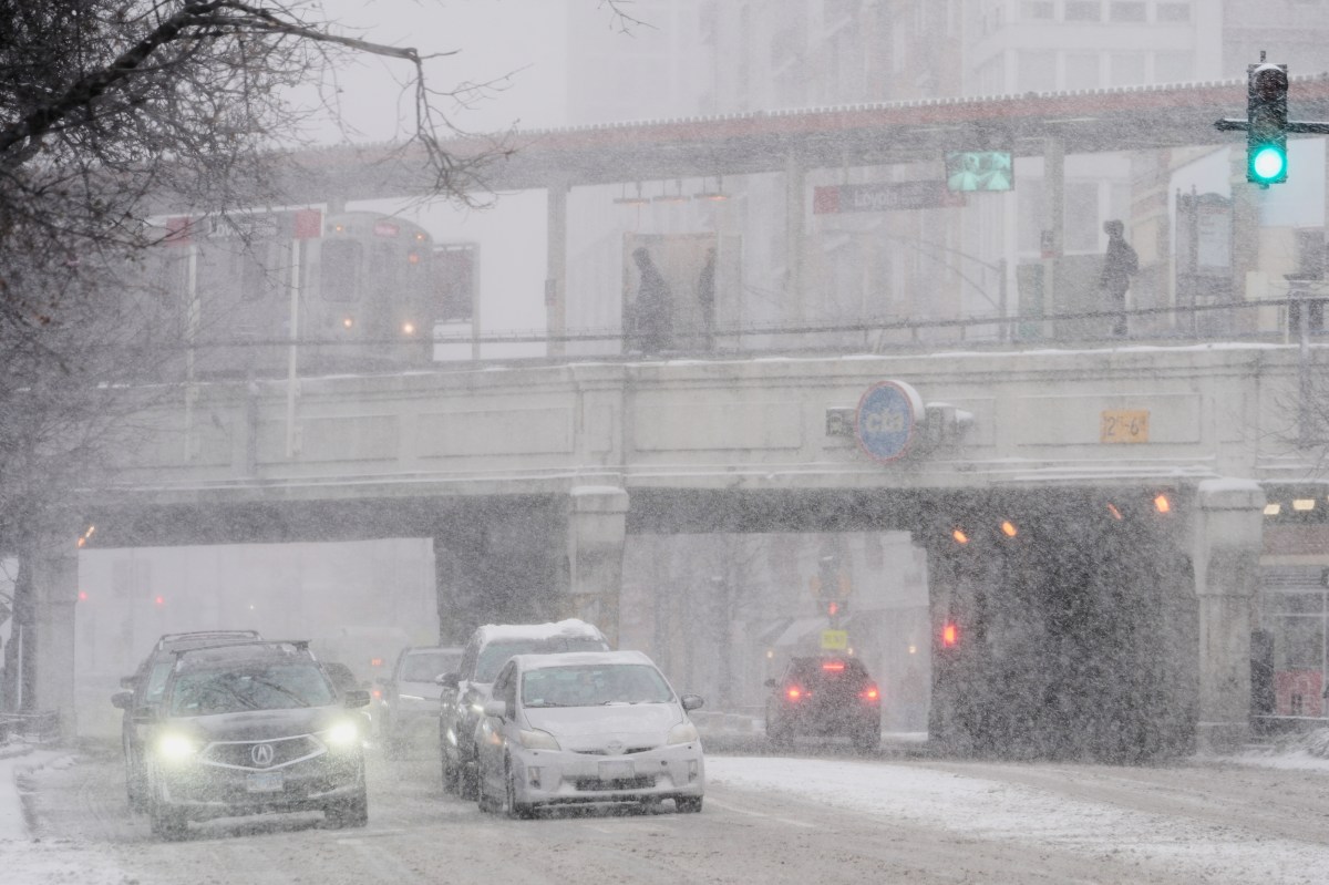
The storm’s impact is felt beyond the Midwest, with thunderstorms and heavy rain expected from southern Missouri to Louisiana and Texas. In Chicago, wind-driven icicles formed on piers as Lake Michigan’s waters churned violently, while motorists battled through snow-covered roads.
Conditions have not reached blizzard warning criteria, which require sustained winds of at least 35 mph and visibility under a quarter mile. However, officials urge everyone to exercise caution. Sheriff Del Garcia of Grant County, Indiana, advised residents:
“Stay home, have a nice cup of hot chocolate, watch some TV, play some games.”
AccuWeather meteorologist Alyssa Glenny stated: “The corridor to face the most notable disruptions includes those within the six-to-12-inch snow bands, including Des Moines, Chicago, Green Bay, Milwaukee, and Grand Rapids.” These areas are projected to experience challenging and dangerous conditions throughout the weekend.
As the storm continues to move through the region, authorities emphasize the importance of monitoring weather forecasts closely. Travelers should prepare for ongoing hazardous road conditions and possible airport delays as snow persists.
Looking ahead, all eyes are on a potential second storm that will track northeastward from the South-Central U.S. into the Northeast corridor. This system could bring additional snowfall from Kansas and Nebraska through the Ohio Valley and into New England, further complicating travel plans for many.
Stay tuned for live updates as the situation evolves.