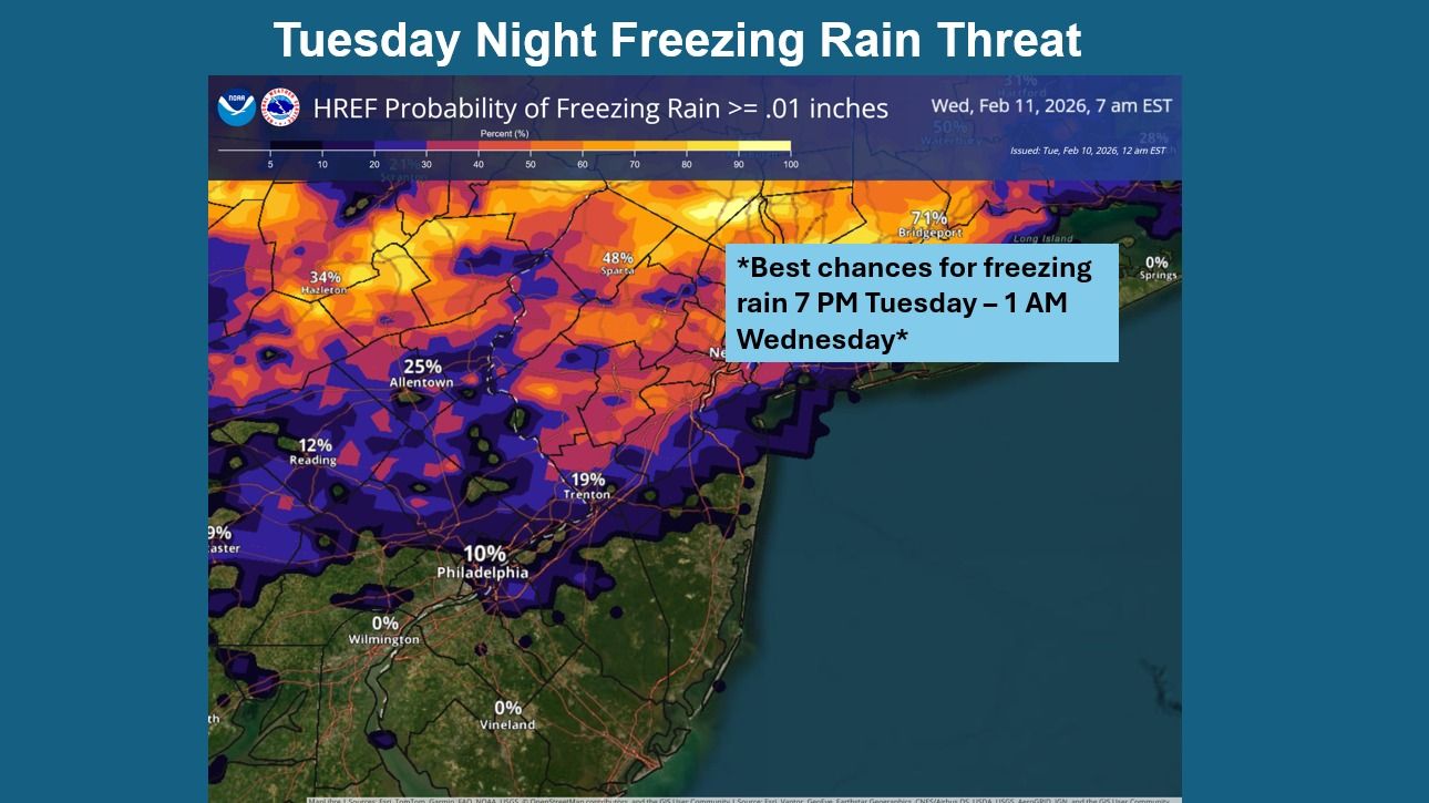
URGENT UPDATE: Freezing rain is set to impact northern regions of Southeastern Pennsylvania and New Jersey tonight, with the potential for icy conditions extending into early Wednesday. The National Weather Service (NWS) in Mount Holly has issued a warning for light icing, primarily affecting areas north of I-78.
According to the latest forecasts from this morning, temperatures are expected to hover around freezing, leading to a mix of light snow, sleet, and freezing rain. The NWS stated, “The forecast challenge is temperatures, precipitation types, and just how much precipitation is realized.” The agency has confirmed that there could be a brief window for light icing this evening, creating hazardous travel conditions.
WHAT TO EXPECT: Tonight’s weather will be mostly cloudy with a low around 28°F and winds shifting from light and variable to west at 5 to 10 mph after midnight.
Looking ahead to tomorrow, Wednesday will see mostly cloudy skies with a high near 39°F. Winds will be stronger, ranging from 10 to 15 mph, with gusts potentially reaching 25 mph. The evening will drop to a low of around 25°F.
In addition to tonight’s freezing rain, the NWS has indicated that a significant storm system may affect the area this weekend. The best chances for precipitation are forecasted for late Sunday into early Monday, which could bring further weather challenges.
IMPACT ON DAILY LIFE: Residents are urged to exercise caution when traveling tonight and into Wednesday morning. Icy roads can lead to dangerous driving conditions, particularly in areas experiencing light icing.
For the latest updates, stay tuned to local news channels and the NWS for any changes in forecasts or warnings. Share this information with friends and family to keep everyone informed and safe during this winter weather event.