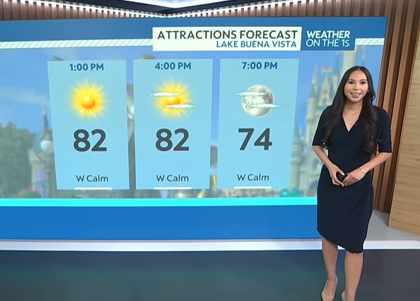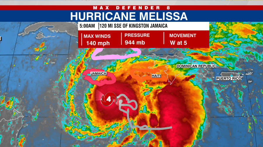
URGENT UPDATE: Hurricane Melissa has rapidly intensified into a Category 4 storm, posing an imminent threat to Jamaica. The National Hurricane Center confirmed this alarming upgrade early Sunday morning, with Melissa now just 120 miles southeast of Kingston, Jamaica, and 280 miles southwest of Guantanamo, Cuba.
The storm is moving west at a sluggish pace of only 5 mph, making its trajectory particularly concerning. Forecast models predict that Melissa will make landfall in Jamaica on Tuesday, before crossing Cuba later that night and impacting the southeastern Bahamas by Wednesday.
Residents in Jamaica and Hispaniola are bracing for catastrophic rainfall amounts between 15 and 30 inches, with eastern Cuba also expecting 6 to 12 inches of rain through midweek. The National Hurricane Center warns that this excessive rainfall can lead to life-threatening flash flooding and landslides across affected areas. Dangerous storm surges are anticipated along Jamaica’s southern coast, further heightening the risk to life and property.
Melissa is forecasted to continue gaining strength, with the possibility of reaching Category 5 intensity by Sunday night. While fluctuations in strength are possible, the storm is expected to maintain its status as a major hurricane upon landfall.
A hurricane warning is currently in effect for Jamaica, while a hurricane watch has been issued for the southwestern peninsula of Haiti and southeastern provinces of Cuba, including Granma, Santiago de Cuba, Guantanamo, and Holguin.
Authorities urge residents to prepare for potential evacuations and to stay tuned for updates as the situation develops. With the storm’s slow movement, the danger of flooding and other impacts will be prolonged, making it critical for everyone in the path of Hurricane Melissa to act swiftly and stay informed.
Stay updated with the latest developments by following Tracking the Tropics every Tuesday at 12:30 p.m. ET or listen on Spotify and Apple Podcasts. Prepare with the 2025 Hurricane Guide and subscribe to the Tracking the Tropics newsletter to stay ahead of tropical developments.