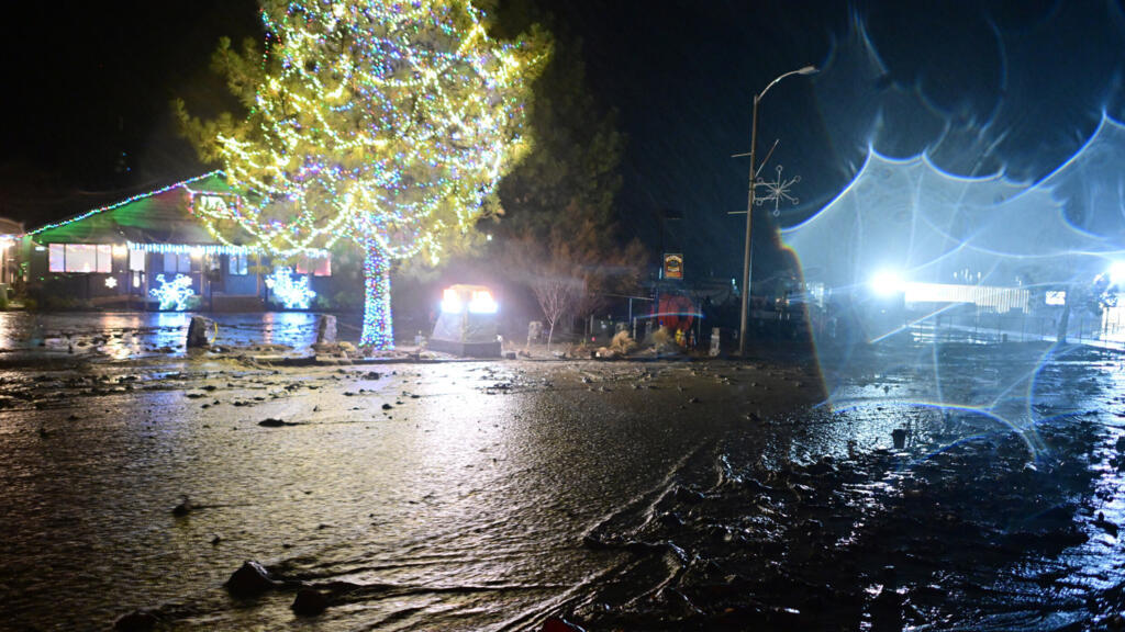
UPDATE: An urgent weather alert has been issued for Northern California as heavy rain is set to continue throughout the day. Following yesterday’s downpour, authorities report that regions north of Sacramento will experience significant rainfall, particularly in the higher elevations.
Flood Advisories are in effect for multiple areas, including Grass Valley and Oroville, where residents are urged to remain vigilant. Since Friday, Blue Canyon has recorded over 10 inches of rain, leading to heightened risks of flooding. The Flood Watch remains active across the viewing area and will extend through Friday.
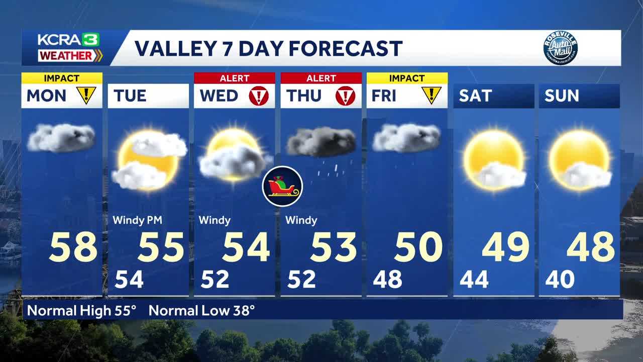
Starting this afternoon, a High Wind Watch is issued for areas west of I-5 to the coast, with south winds expected to gust up to 60 mph. This could result in damage to trees and power lines, exacerbating the already precarious situation for residents.
Looking ahead, Wednesday and Thursday are designated as Alert Days as forecasts indicate the arrival of more rain, strong winds, and heavy snowfall. Snow levels are predicted to drop to 5,500 feet tonight, with 4-6 feet of snow expected around Donner and Echo Summits. Even more alarming, up to 10 feet of snow could blanket the Sonora Pass region by Friday afternoon.
Residents should prepare for hazardous conditions and plan accordingly as authorities continue to monitor the situation. Sunshine is expected to return this weekend, but temperatures will remain chilly, leaving many to wonder about the long-term effects of these extreme weather patterns.
Stay tuned for updates as this situation develops. Share this information with others to ensure everyone remains informed and safe during this Impact Day.