UPDATE: Central Indiana is bracing for significant snow accumulation starting Thursday night into early Friday, according to the WRTV Storm Team. As colder air settles in, residents should prepare for potentially hazardous travel conditions as snow overspreads the region.
Gusty winds have plunged temperatures into the middle 20s, with overnight lows expected to drop to 25°F. Thursday will remain gray and cloudy, with temperatures barely reaching the 30°F mark. Though flurries are possible throughout the day, the real concern lies in the evening when accumulating snow is predicted to impact the evening commute, particularly in western areas.
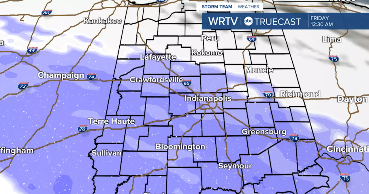
The weather system moving in Thursday evening could bring a band of 1-3 inches of snow along and southwest of a line from Lafayette to Richmond, with higher amounts of 3-5 inches expected across central and southern parts of the state. However, the exact snow totals are still uncertain as weather patterns continue to develop.
Another wave of light snow is anticipated on Saturday, coinciding with the coldest air of the season, pushing Sunday highs into the single digits. Wind chills are expected to drop even lower, making this a potentially dangerous stretch of weather.
Residents in Central Indiana should stay vigilant and monitor weather updates as conditions evolve. The urgency of this situation cannot be overstated; travel may become treacherous as snow begins to accumulate.
Forecast details are as follows:
– **Tonight:** Cloudy, low of 25°F
– **Thursday:** Cloudy with possible flurries, high of 31°F
– **Thursday Night:** Snow likely, low of 26°F
– **Friday:** Mostly cloudy, high of 33°F
– **Saturday:** Light snow likely, high of 19°F
For the latest updates and full weather forecasts, stay tuned to WRTV as this developing situation unfolds. Share this urgent weather alert with friends and family to keep everyone informed and safe during this winter storm.