UPDATE: A Winter Storm Warning is now in effect for the Chicago area until 6 a.m. Sunday, as a significant snowstorm threatens to drop up to 8 inches of snow in the next 24 hours. The warning will expire at midnight on Sunday for counties in Illinois and Indiana, including Ford, Iroquois, Benton, Jasper, and Newton.
This morning, residents awoke to flurries and light snow, but forecasters from ABC7 AccuWeather predict that the heaviest snowfall will occur between noon and 8 p.m. Saturday. Travelers are urged to stay alert as conditions worsen.
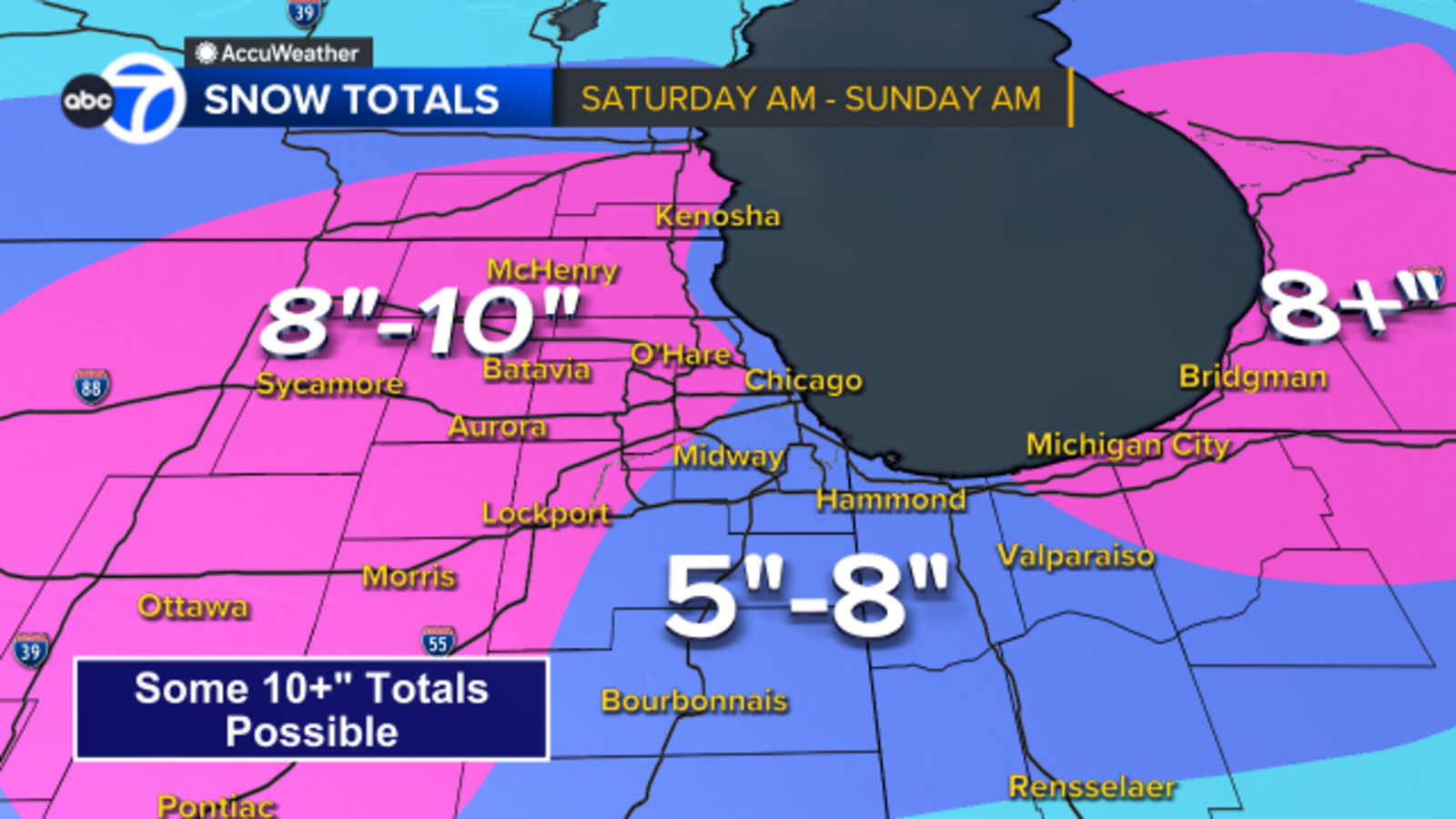
Areas within and around Chicago, as well as parts of Northwest Indiana, could see between 5 to 8 inches of snow, while regions to the north and west may receive more than 8 inches. Wind gusts are projected to reach up to 30 miles per hour, creating hazardous driving conditions.
The Illinois Tollway has issued a cautionary reminder for holiday travelers returning home after Thanksgiving. With the snow accumulating, safety on the roads is paramount as many families hit the highways.
After the storm passes, temperatures will plummet, with overnight lows expected in the single digits. This cold snap will add another layer of difficulty for those traveling across the Midwest and East Coast, posing dangers for thousands making their way home.
This developing situation requires immediate attention, and residents are encouraged to stay tuned for updates as the storm progresses. Prepare for possible disruptions, and consider altering travel plans if necessary.
Stay safe and warm as this winter storm unfolds. More updates to follow as conditions change.